In the beginning
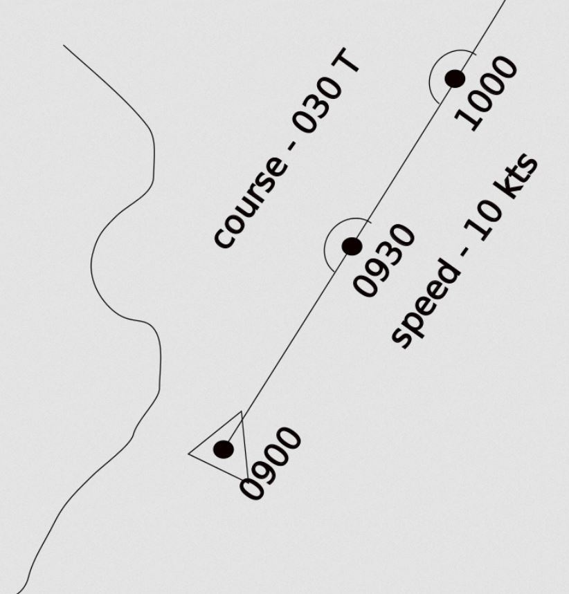
Early pilots used dead reckoning to arrive at their destination
From dead reckoning to a compass, to navigation by the stars, radio beacons and GPS.
The first long flights were accomplished with a compass and a lot of luck.
But many of these early aviators who gave their lives in the pursuit of endurance and distance records simply disappeared.
Once pilots began to travel beyond what they knew and recognized they had to find a way to navigate accurately.
To determine your position on the surface of the earth you need to know your latitude, your longitude and your altitude.
The problem of determining latitude was solvable by a) measuring the angle of the sun at it highest point, or b) if you were in the northern hemisphere, you could measure the angle of the north star “Polaris”, from the horizon, usually done at twilight.
Longitude however, was a much thornier problem. In order to determine accurate longitude, you needed to know the time. This was solved in the 18th century by James Harrison with the invention of the marine chronometer.
“The purpose of a chronometer is to measure accurately the time of a known fixed location. This is particularly important for navigation. As the Earth rotates at a regular predictable rate, the time difference between the chronometer and the ship’s local time can be used to calculate the longitude of the ship relative to the prime meridian.” – excerpt from Wikipedia, Marine Chronometer.
The marine chronometer worked well for ships at sea and indeed was in service well into the 21st century as a method to determine longitude.
However from the air a marine chronometer was not practical. A plane could not easily keep a chronometer stable enough to ensure accuracy, nor could a pilot in an early plane leave the controls long enough to check the chronometer and plot their position.
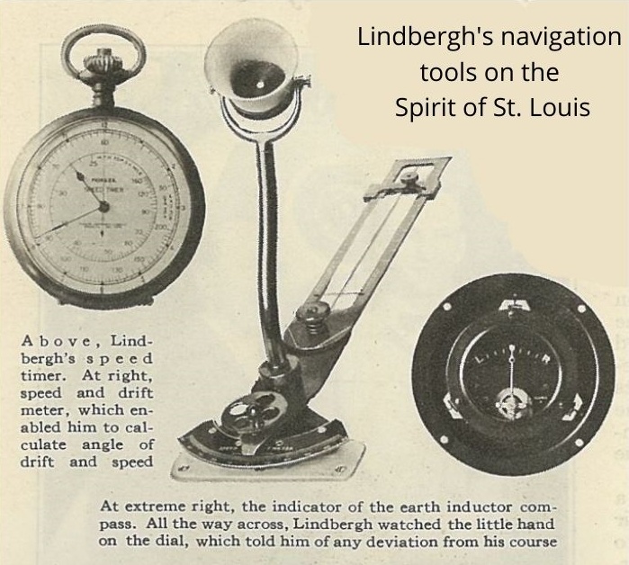
Charles Lindbergh’s navigational tools onboard the Spirit of St. Louis during on his transatlantic flight, in 1927, consisted of an earth inductor compass, a drift sight, a speed timer (a stopwatch for the drift sight), and an eight-day clock (not pictured here). He reached the coast of Ireland using these methods within 5 km (3 miles) of his course. However, it was chance, not skill that allowed him this victory, because he had no significant drift from winds during the flight.
With this and subsequent journeys, Lindbergh recognized the need for better navigation.
Philip Van Horn Weems
In 1927 Longines collaborates with Philip Van Horn Weems to help produce the Weems System of Navigation, enabling the watch to be synchronized with the aid of a GMT signal
The seconds-setting watch works with a rotating bezel or inner dial (disc). These watches were the first in the world to have these features.
“By ordinary methods it requires from fifteen minutes to half an hour to plot a position. . . . Weems’ simplified method reduces this time to forty seconds on a starlit night, or two minutes by day.”
— Popular Science Monthly, August 1928
In 1928 Lindbergh gets lost near Cuba, following this incident, Lindbergh seeks help from Weems and studied navigation with Weems for a month in 1928. Following this Lindbergh puts forward a design for a watch that would function as a proper navigation instrument.
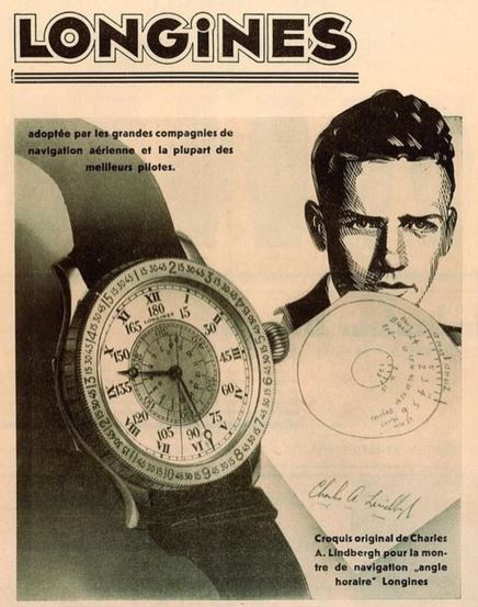
In 1931, Longines collaborates with Charles Lindbergh to produce the Longines Lindbergh watch. Officially known as The Longines Lindbergh Hour Angle Watch, based on the Weems design allows calculation of Longitude.
Both the central seconds’ dial and the bezel, calibrated in angular degrees (Greenwich Sidereal Time) rotate. Sideral Time or Star Time is based on the rotation of the earth relative to the stars.
When used in conjunction with a sextant, a nautical almanac, and Latitude it allows precise navigation.
More technology to come soon.